
CUAV C-RTK 2 HP GNSS Heading Module
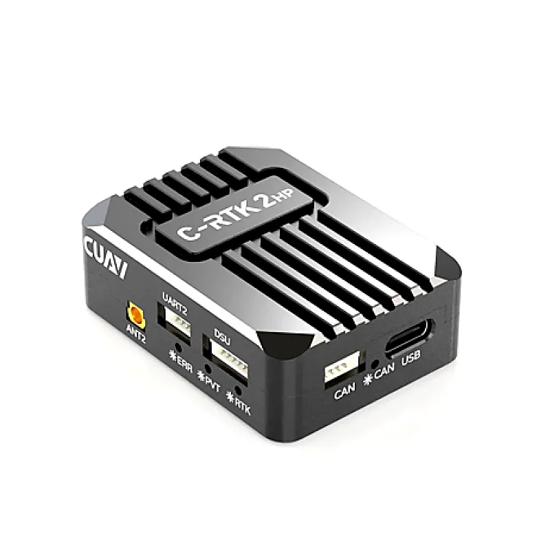
CUAV C-RTK 2 HP GNSS Heading Module
Its CUAV C-RTK 2 HP GNSS Heading Module from CUAV! The module utilizes multiple satellite constellations, such as GPS, GLONASS, Beidou, and Galileo, to provide high-precision positioning down to the centimeter level. This level of accuracy is crucial for applications like drone navigation, where pre
+ 18% GST (added at checkout)
In stock — 19 units ready
- Centimeter-Level Positioning
- Single Module Dual Antenna Estimate yaw
- All-constellation Multi-frequency Receiver
- Supports Drone CAN Protocol
- Sensor: Compass: RM3100, Grro/ACC: ICM42688
- Antenna 1 (main): BDS:B11, B21, B31; GPS:L1C/A, L2P/L2C, L5; GLONOSS:L1, L2; Galileo: E1, E5a, E5b; QZSS:L1, L2, L5
- Antenna 2: BDS:B11, B21, B31 GPS:L1C/A, L2C; GLONOSS:L1, L2 Galileo: E1, E5b QZSS:L1, L2
- Position Accuracy: Single point positioning: horizontal 1.5M/elevation: 2.5m DGPS (assisted positioning): horizontal 0.4M+1PPM/ elevation: 0.8m+1 PPM, RTK: Horizontal 0.8cm+1PPM/Elevation: 1.5cm+1PPM
- Estimate yaw accuracy: 0.2 degrees/1m (distance between antenna 1 and antenna 2)
- Max star: Single: 28+ RTK:50 +
- Positioning speed: Cold start <30s/auxiliary start <5s
- Data refresh rate: 5Hz (default); Max 20Hz
- Data format: RTCM3.X
- Data protocol: Dronecan/NMEA
- Interface: Antenna interface *2, CAN*1, UART*1, DSU*1, USB*1
Buying in bulk?
Get volume pricing, GST invoicing and stock availability for larger quantities of this item.
Its CUAV C-RTK 2 HP GNSS Heading Module from CUAV! The module utilizes multiple satellite constellations, such as GPS, GLONASS, Beidou, and Galileo, to provide high-precision positioning down to the centimeter level. This level of accuracy is crucial for applications like drone navigation, where precise location data is essential. The dual-antenna configuration helps in determining not only the position but also the heading or orientation of the device. This is particularly valuable for applications like precision agriculture, where the orientation of equipment matters. Many GNSS modules, including the CUAV New C-RTK 2HP, incorporate an IMU for measuring changes in orientation and velocity. This enhances the performance in dynamic and challenging environments. The module is designed to operate in various environmental conditions, including extreme temperatures and humidity levels. Note: Refer to Interface Design in the ATTACHMENTS section for more info. Features: Centimeter-Level Positioning Single Module Dual Antenna Estimate yaw All-constellation Multi-frequency Receiver Supports Drone CAN Protocol Sensor: Compass: RM3100, Grro/ACC: ICM42688 Antenna 1 (main): BDS:B11, B21, B31; GPS:L1C/A, L2P/L2C, L5; GLONOSS:L1, L2; Galileo: E1, E5a, E5b; QZSS:L1, L2, L5 Antenna 2: BDS:B11, B21, B31 GPS:L1C/A, L2C; GLONOSS:L1, L2 Galileo: E1, E5b QZSS:L1, L2 Position Accuracy: Single point positioning: horizontal 1.5M/elevation: 2.5m DGPS (assisted positioning): horizontal 0.4M+1PPM/ elevation: 0.8m+1 PPM, RTK: Horizontal 0.8cm+1PPM/Elevation: 1.5cm+1PPM Estimate yaw accuracy: 0.2 degrees/1m (distance between antenna 1 and antenna 2) Max star: Single: 28+ RTK:50 + Positioning speed: Cold start Data refresh rate: 5Hz (default); Max 20Hz Data format: RTCM3.X Data protocol: Dronecan/NMEA Interface: Antenna interface *2, CAN*1, UART*1, DSU*1, USB*1 Package Includes: 1 x CUAV C-RTK 2 HP GNSS Heading Module & Accessories as shown in image. Attachments : Download
You may also need
CUAV C-RTK 2 HP GNSS Heading Module